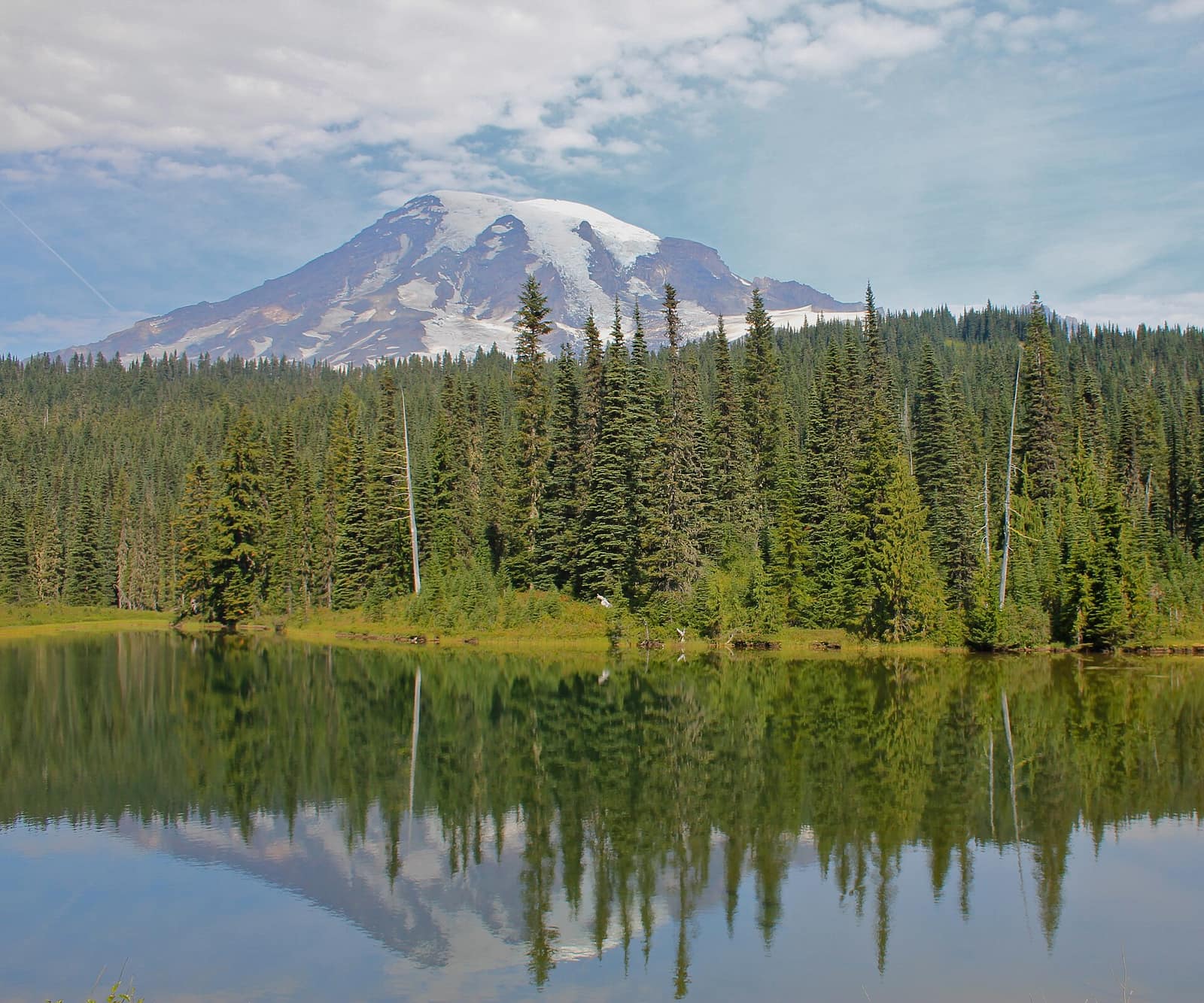
Washington State has three national parks, and they have almost nothing in common. Olympic National Park spans three distinct ecosystems along the Olympic Peninsula: temperate rainforest, Pacific coastline, and alpine mountains. Mount Rainier National Park is built around an active stratovolcano that rises 14,411 feet above sea level and is visible from Seattle on a clear day. North Cascades National Park holds more glaciers than any park south of Alaska, in terrain so rugged that large portions weren’t mapped until the 20th century. All three are within a day’s drive of Seattle. That combination, three entirely different parks in close proximity, is rare anywhere on the West Coast.
Washington’s Three National Parks at a Glance
Before diving into each park, here’s the quick overview:
Olympic National Park covers 922,000 acres on the Olympic Peninsula, encompassing temperate rainforest, Pacific coastline, and glacier-clad mountains. It’s roughly 2.5 hours from Seattle by car and ferry.
Mount Rainier National Park protects 236,000 acres around the dominant stratovolcano of the Cascade Range. Two main visitor corridors serve the park: Paradise on the south side and Sunrise on the northeast. Both are about 2.5 hours from Seattle.
North Cascades National Park anchors a larger complex that includes Ross Lake National Recreation Area and Lake Chelan National Recreation Area. Access via State Route 20 puts the park 2.5 to 3 hours from Seattle, though the highway closes in winter.
All three parks are covered by the America the Beautiful Annual Pass ($80), which pays for itself in a single multi-park trip at current entrance fees of $30 to $35 per vehicle.
Olympic National Park: Three Ecosystems in One Visit
Most national parks offer one defining landscape. Olympic delivers three within a single visit, which is part of why it draws more than three million people per year.
Hurricane Ridge and the Alpine Interior
The park’s alpine interior is most easily reached via Hurricane Ridge Road, which climbs from Port Angeles to 5,242 feet. At the top, subalpine meadows spread out in every direction, with black-tailed deer grazing close to the parking lot. On a clear day, the Strait of Juan de Fuca and the southern coast of Vancouver Island are visible to the north. The Hurricane Ridge Visitor Center operates year-round (weekends only in winter) and is the starting point for several day hikes, including the 3.2-mile Hurricane Hill Trail, which follows a ridgeline with continuous views of the Olympic Mountains.
The Hoh Rain Forest
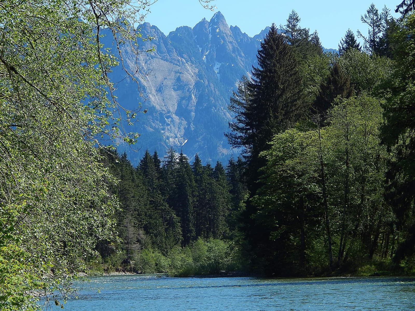
On the park’s western side, the Hoh Rain Forest receives 140 to 170 inches of rain each year, producing old-growth Sitka spruce and bigleaf maple draped in club moss so dense that midday light filters through green. The Hall of Mosses trail, a half-mile loop from the Hoh Rain Forest Visitor Center, is one of the most memorable short walks in the Pacific Northwest. The Hoh River Trail begins at the same trailhead and extends 17 miles into the backcountry toward the Blue Glacier on Mount Olympus for those with a multi-day permit.
The Pacific Coastline
Olympic is one of the few national parks with a stretch of undeveloped Pacific coast. Rialto Beach, north of the Quileute village of La Push, offers sea stacks and tidal pools, with the arched formation called Hole-in-the-Wall accessible at low tide about 1.5 miles north of the trailhead. Ruby Beach, 30 miles south along US-101, is known for its red rock outcroppings and reliable evening light. Neither beach requires a permit for day use.
Sol Duc Hot Springs
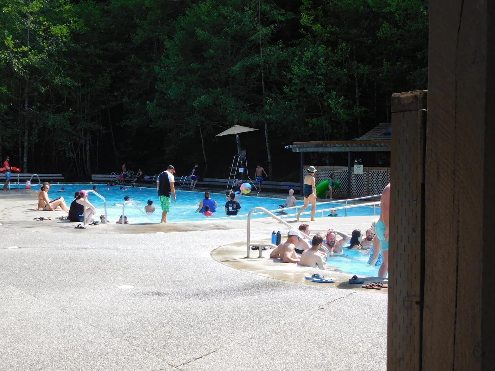
Inside the park’s western interior, Sol Duc Hot Springs is a resort operated by Delaware North under a National Park Service concessionaire agreement. Three mineral pools are open to day visitors for a fee. The resort is also the trailhead for Sol Duc Falls, a 1.6-mile walk to a four-channel falls widely considered one of the most rewarding short hikes on the peninsula.
Planning to camp at Olympic? Reservations at Hoh, Sol Duc, and Kalaloch campgrounds fill weeks in advance during summer.
Mount Rainier National Park: Washington’s Dominant Peak
On days when Rainier is visible from Seattle, people notice. The mountain rises 14,411 feet from a base that sits at about 2,000 feet elevation, a vertical gain so abrupt that the volcano creates its own weather systems. Getting into the park means choosing a gateway: Paradise on the south side or Sunrise on the northeast.
Paradise
The Paradise area sits at 5,400 feet and is the most-visited section of the park. In late July and early August, the meadows around the Henry M. Jackson Visitor Center host one of the most concentrated wildflower displays in the Pacific Northwest, with subalpine lupine, Cascade phlox, and beargrass covering open slopes that stayed snow-covered through June. The Skyline Trail loops 5.5 miles above the meadows toward Panorama Point, a popular turnaround before the technical terrain of the Muir Snowfield begins.
Paradise Inn, built in 1916, offers lodging inside the park. Reservations open in January and sell out quickly for summer weekends.
Sunrise
At 6,400 feet, Sunrise is the highest point accessible by road in the park. The road opens in early July and closes by late September, giving it a shorter season than Paradise. From the parking area, the volcano fills the western view. The Sourdough Ridge Trail follows the ridgeline for 2.5 miles with continuous views of the mountain, and on clear days, Mount Adams and Mount Hood are visible to the south.
Paradise in Every Season
The Paradise visitor area operates from late May through mid-October, with the Henry M. Jackson Visitor Center open daily. The Carbon River corridor on the park’s northwest edge is worth noting for visitors who want to avoid crowds: it holds a temperate rainforest ecosystem and sees a fraction of the traffic at Paradise, making it a good option for weekday visits.
Mount Rainier recently implemented a timed-entry reservation system for the Sunrise area during peak season. Check the park’s official reservation page before driving up on summer weekends.
North Cascades National Park: The American Alps
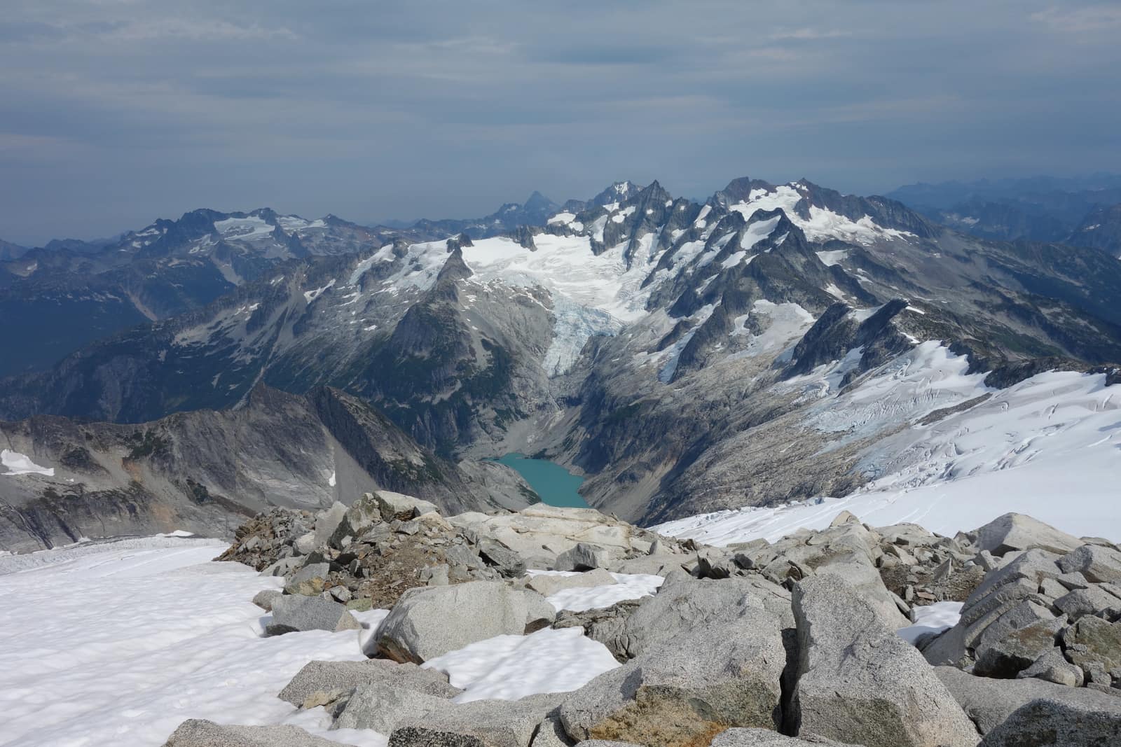
North Cascades is the least-visited of Washington’s three national parks and arguably the most striking in raw terrain. The park complex protects 684,000 acres of glacier-carved peaks, with more than 300 glaciers remaining in a landscape where summits regularly exceed 8,000 feet. The hiking is serious and the solitude is real: many trails in the park’s wilderness core go days without seeing another party.
Most visitors access the park via the SR-20 corridor, driving the North Cascades Highway through the Ross Lake National Recreation Area. The highway is open from late April to mid-November, weather permitting, and the drive itself through Gorge Creek and past Diablo Dam is reason enough to make the trip.
Diablo Lake
The turquoise-green color of Diablo Lake is produced by glacial flour, fine rock particles suspended in runoff from surrounding glaciers. The Diablo Lake Overlook, a short pull-off along SR-20, is the easiest viewpoint. For a closer look, the Diablo Lake Trail (7.6 miles round-trip from Colonial Creek Campground) traces much of the shoreline through old-growth forest. Camping near Diablo Lake is available at Colonial Creek, with tent and RV sites reservable through Recreation.gov.
Cascade Pass
The Cascade Pass Trail is a 7.4-mile out-and-back hike and the park’s signature day hike. The trailhead sits at the end of a 23-mile unpaved road from Marblemount. The trail gains about 1,800 feet to the pass at 5,392 feet, where the Ptarmigan Ridge extends southeast with glaciated peaks in every direction. Start before 8am to secure a parking spot at the trailhead; it fills completely by mid-morning on summer weekends.
Washington Pass Overlook
About 20 miles east of Diablo Lake along SR-20, Washington Pass Overlook provides views of Liberty Bell Mountain and the Early Winters Spires, a cluster of granite towers that draw technical climbers from across the country. The loop from the parking area is about 0.3 miles and accessible to anyone.
The North Cascades Visitor Center in Newhalem operates summers only and is the main interpretive facility for first-time visitors. The Wilderness Information Center in Marblemount is where to pick up backcountry permits for the park’s interior.
When to Visit Washington State’s National Parks
July through September is the reliable window for all three parks. That’s when high-elevation trails are snow-free, park roads are fully open, and visitor centers are staffed. Some more specific notes:
Olympic is the most flexible. The Hoh Rain Forest, the Pacific coast beaches, and the lower-elevation campgrounds are accessible year-round. Hurricane Ridge Road closes at night and in winter, except for designated winter weekends when conditions allow.
Mount Rainier: Paradise typically loses its seasonal snowpack in late June. Some years a heavy winter delays the wildflower season into mid-July. Sunrise opens a few weeks after Paradise and closes first in fall. Both areas have flush toilets and food service when open.
North Cascades: SR-20 closes in late October or November and reopens in late April. The Cascade Pass trailhead road has additional seasonal closures within that window. Check the park’s road conditions page before planning a late-season trip.
If you can only go in shoulder season, Olympic gives you the most options.
Combining All Three Parks in One Trip
A 10-day road trip from Seattle can cover all three parks without feeling rushed. One practical sequence:
- Drive SR-20 through North Cascades on the way east, spend two to three days in the park complex
- Loop south via US-2 or I-90 to Mount Rainier, base yourself at Paradise or Ashford for two to three days
- Take the Bremerton-Seattle or Kingston-Edmonds ferry connection to the Olympic Peninsula for three to four days
The three parks are geographically spread, not along a single highway. But the ferry connections from the Seattle area make a circular route practical and reduce backtracking. Total driving for the loop runs roughly 600 to 700 miles. All three parks are covered by the America the Beautiful Pass, so entrance fees stop being a factor once you buy one.
For visitors with five to six days, Olympic and Mount Rainier pair well together: ferry to the Olympic Peninsula on day one, work through the rainforest and coast, cross back and drive to Rainier for the last two days.
Getting Started
Washington’s national parks reward visitors who plan ahead. Backcountry permits at Olympic and Mount Rainier sell out weeks before summer weekends. Hurricane Ridge road can back up without a timed-entry reservation. North Cascades requires the most logistical planning but delivers the widest ratio of wilderness to other visitors. For first-time visitors to the state, start with Olympic for its range, add Rainier for the volcano, and save North Cascades for when you’re ready for something more remote. All three are worth the trip.
Hero photo: Mt Rainier & Reflection Lakes (8082913563) by Navin75, licensed CC BY-SA 2.0, via Wikimedia Commons. Resized.
.jpg)