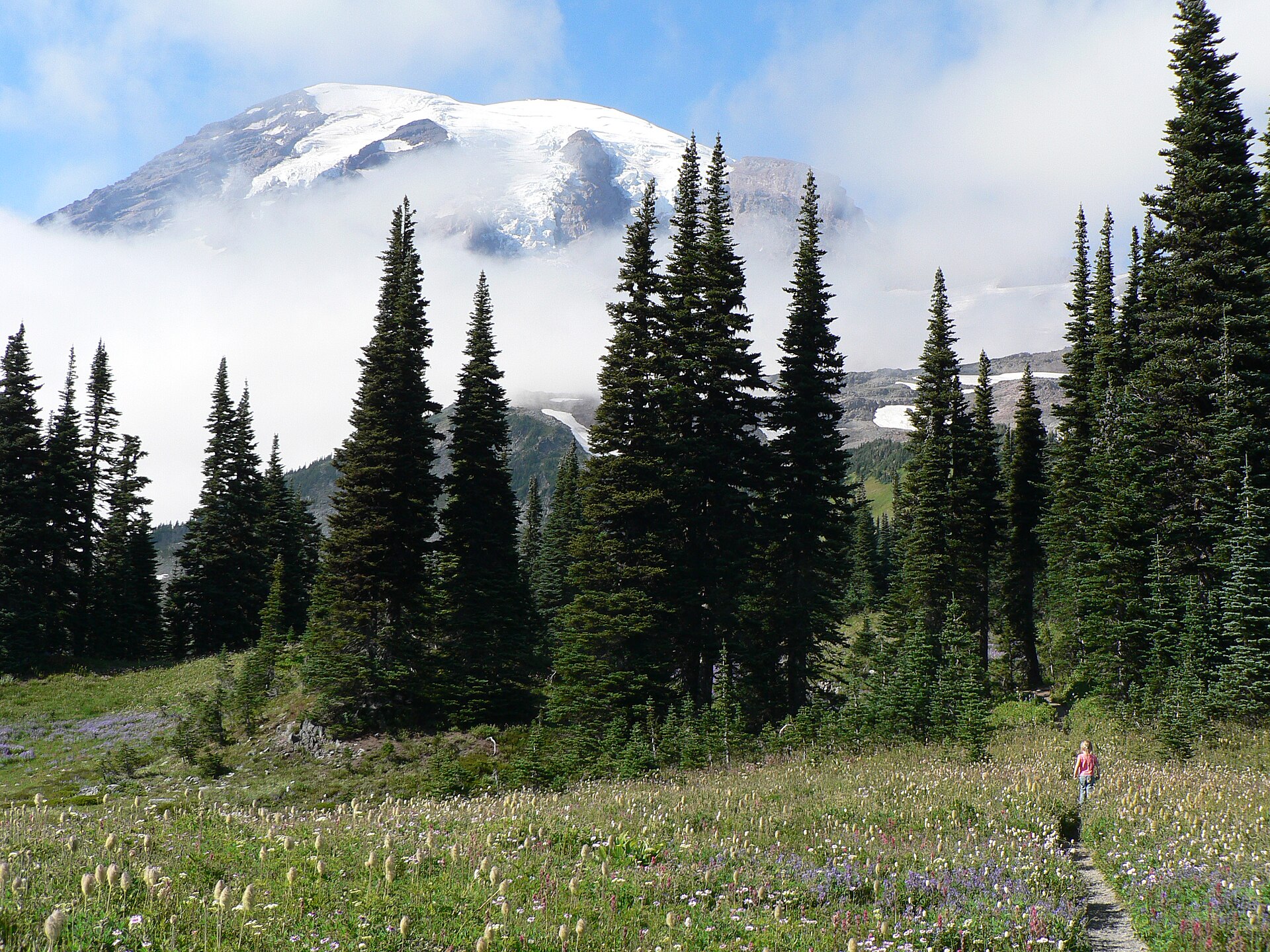
Stand at the Paradise visitor center on a clear July morning and you understand, immediately, why Mount Rainier is Washington’s most visited national park. The mountain fills the sky above you (14,411 feet of glaciated volcano) and the meadows in front of you are exploding in lupine and paintbrush. The air smells like cold stone and subalpine fir. You have one day. Where do you go?
This guide to Mount Rainier day hikes covers eight trails across every ability level, organized by what you can realistically accomplish in a single day trip. Whether you have two hours or ten, there’s a route here that earns the drive.
Before You Go: Permits, Parking, and Season
Mount Rainier requires a timed entry permit for the Paradise and Sunrise areas during peak season (mid-June through Labor Day). Permits are released 30 days in advance at recreation.gov and sell out within minutes on the day they drop. Book the moment your 30-day window opens, or aim for a weekday trip when demand is lower.
The park entry fee is $35 per vehicle (valid for 7 days). America the Beautiful passes cover it. If you arrive before 9am or after 3pm at Paradise, you can often find parking without a permit during shoulder season (early June or September). Check current conditions on the NPS Mount Rainier page before you leave home.
Season window: Trails at Paradise (5,400 ft) are typically snow-free by mid-July. Sunrise (6,400 ft) opens later, usually early July, and closes to vehicles by mid-October. Low-elevation trails around Longmire are walkable year-round.
Bring layers regardless of the forecast. Paradise gains or loses 20 degrees in an hour when clouds move through.
Easy Hikes: Good Views With Minimal Effort
Alta Vista Summit Trail
Distance: 1.7 miles round trip | Elevation gain: 500 feet | Starting point: Paradise parking lot
This short climb rewards you fast. The trail starts at the upper Paradise parking lot and switchbacks through open meadows to a knoll overlooking the Tatoosh Range to the south and the mountain to the north. On a clear day the view up toward the Nisqually Glacier is as good as anything you’ll see on a longer hike.
It’s the right choice if you’re hiking with older family members, have limited time, or just arrived and want to orient yourself before committing to something longer. Do it in the morning before the afternoon crowds turn the trailhead into a bottleneck.
Emmons Moraine Trail
Distance: 3 miles round trip | Elevation gain: 300 feet | Starting point: White River Campground
This is the easiest meaningful hike in the Sunrise corridor. The trail follows the lateral moraine of the Emmons Glacier (the largest glacier in the contiguous US by area) and puts you face-to-face with a river of ice at close range. You can look down into the crevasse field from the end of the moraine and watch meltwater streams cut channels through gray debris.
The trailhead at White River Campground sits at 4,400 feet, lower than Sunrise proper, so it stays accessible earlier in summer. A good choice if Sunrise Road hasn’t fully opened yet.
Moderate Hikes: The Sweet Spot
Naches Peak Loop
Distance: 3.5 miles | Elevation gain: 600 feet | Starting point: Chinook Pass (Highway 410)
The Naches Peak Loop is the most efficient wildflower hike in the park. Half the trail runs through Mount Rainier National Park; the other half crosses into Norse Peak Wilderness. You get two different ecosystems, a small lake with a Rainier reflection, and a ridge walk with views east toward the Yakima drainage.
The trailhead sits at Chinook Pass on Highway 410, which means you can reach it from Yakima as easily as from the Puget Sound side. If you’re coming from Eastern Washington, this is your best entry point into the park’s subalpine terrain. Peak bloom runs mid-July to early August depending on snow year.
Skyline Loop at Paradise
Distance: 5.5 miles | Elevation gain: 1,500 feet | Starting point: Paradise parking lot
The Skyline Loop is the backbone hike at Paradise. You gain enough elevation to see all the way to Mount Adams and Mount Hood on clear days, pass within a quarter mile of the Nisqually Glacier terminus, and spend a solid mile in open meadow above tree line. The climb to Panorama Point (6,800 ft) is the highlight: a rocky saddle where the mountain fills three-quarters of your field of view.
This trail works for anyone who hikes regularly. The 1,500-foot gain is spread over 2.5 miles, so the grade is steady rather than brutal. Budget 3-4 hours and carry water, since there’s no reliable source on the route.
Burroughs Mountain via Frozen Lake
Distance: 6.8 miles round trip | Elevation gain: 900 feet | Starting point: Sunrise parking lot
Start at Sunrise, the highest point you can drive to in the park (6,400 ft), and hike to First and Second Burroughs Mountain for an above-treeline ridge walk with 360-degree views. The terrain above Frozen Lake is lunar: black volcanic rock, no trees, just the mountain and sky.
This is one of the best hikes in the park for seeing the north and east faces of Rainier, which look completely different from the south side. On clear days you can spot Emmons Glacier flowing all the way to White River valley below. Wildlife is common up here: marmots on the talus, the occasional black bear on the slopes below.
For more on what to do in the Sunrise area, the park’s Sunrise visitor guide covers current trail conditions and seasonal closures.
Challenging Hikes: For Experienced Hikers
Spray Park Trail
Distance: 8 miles round trip | Elevation gain: 2,200 feet | Starting point: Mowich Lake
The northwest corner of the park gets a fraction of Paradise’s foot traffic, which means Spray Park feels like a different world. You earn the views here: the first 2 miles gain elevation through old-growth forest, then the trail breaks into wide open meadows at 5,800 feet. The flower display rivals Paradise at peak season, but you’ll share it with far fewer people.
Mowich Lake Road is unpaved for its last several miles. Drive a vehicle with decent clearance and allow extra time. This trail is typically snow-free by late July.
Camp Muir via Muir Snowfield
Distance: 8.5–9 miles round trip | Elevation gain: 4,500 feet | Starting point: Paradise
Camp Muir at 10,180 feet is the upper limit of a true day hike at Rainier. It’s the base camp for summit climbers, and you’ll pass them gearing up while you eat lunch on a rock and stare down at clouds covering the Puget Sound lowlands below.
The route follows the Skyline Loop to Panorama Point, then continues up the Muir Snowfield, a broad, open snow slope that requires an ice axe and crampons in early season (before mid-August). In late summer the snowfield is walkable in boots, though still demanding. Altitude is a real factor at this elevation: allow extra time, stay hydrated, and turn around if you develop a headache.
This is a full-day commitment: 6-8 hours round trip for fit, experienced hikers. Do not attempt without sun protection, wind layers, and navigation tools. Cloud conditions can change within 30 minutes.
Sunrise vs. Paradise: Which Area Should You Visit?
Go to Paradise if: You want wildflower meadows, the most-developed visitor facilities, and views of the mountain’s southwest face. It’s 1,000 feet lower than Sunrise, opens earlier in summer, and has more trail variety. Paradise is also better for families with young children.
Go to Sunrise if: You want fewer crowds, higher elevation, and views of the mountain’s north and east faces (the less-photographed angles). The Burroughs Mountain trails are among the best day hikes in the park and are less crowded than anything at Paradise on summer weekends.
You can visit both in one day if you’re willing to drive the connector roads (about 1.5 hours between the two areas via Cayuse Pass). Start at Sunrise for the morning light, then drop to Paradise for afternoon hikes when cloud buildup is less likely.
Trail Etiquette at Rainier
A few specifics that matter at this park:
- Stay on trail in meadows. The subalpine vegetation takes decades to recover from foot traffic. The park has closed several informal paths in recent years due to damage.
- Dogs are not allowed on park trails. Leave them at the campground or at home.
- Bear canisters are recommended in the backcountry but not required for day hikes. Black bears are active in the park; don’t leave food in your car at trailheads near meadow areas.
- Restrooms at Sunrise and Paradise are the last facilities before you head into the backcountry. Use them before starting.
Getting There and Where to Stay
From Seattle, Paradise takes about 2.5 hours via Highway 7 south to Highway 706 (Nisqually entrance). From Tacoma, it’s under 2 hours. The Carbon River and White River entrances on the northeast side add 30-45 minutes from Seattle but give access to Sunrise.
Lodging inside the park is limited to Paradise Inn (historic lodge, book early) and National Park Inn at Longmire. Outside the park, Ashford has the highest concentration of vacation rentals and small inns, most within 5 miles of the Nisqually entrance. Packwood, 20 miles east on Highway 12, is quieter and less expensive.
For a broader look at Washington’s national parks, including North Cascades and Olympic, see our full parks guide. If you’re planning a longer trip, the Olympic Peninsula road trip itinerary pairs well with a Rainier day.
Planning your timing? The best time to visit Washington State breaks down conditions month by month across the full state, including what to expect at higher elevations in shoulder season.
The park rewards commitment. Get the permit, start early, and give yourself time above tree line. That’s the formula.