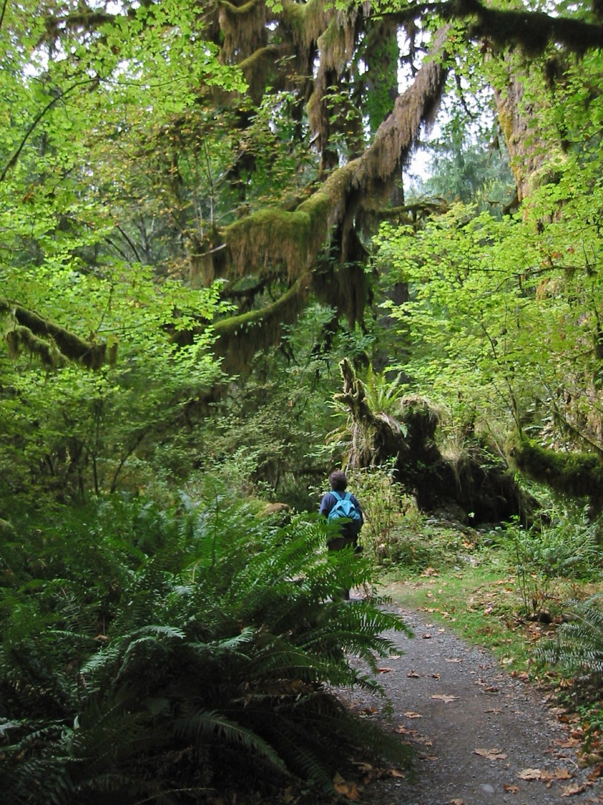
The moss hits you first. Before you register the scale of the old-growth canopy or find your footing on the rooted path, the forest closes around you in a way that most forests don’t. That’s the Hoh Rain Forest, and it’s the introduction most visitors get to hiking the Olympic Peninsula. But the Hoh is one chapter in a much larger story. Olympic National Park holds five distinct ecosystems: temperate rain forest, alpine meadow, wild Pacific coast, river valley old-growth, and volcanic subalpine terrain. The peninsula delivers more variety per trail mile than nearly anywhere else in the Pacific Northwest, and it remains less crowded than the more famous corridors of the Cascades.
This guide covers the best trails for day hikers and backpackers, organized by zone, with the practical details you need to plan the trip.
The Hoh Rain Forest Trails
The Hoh Rain Forest receives 140 to 170 inches of rain per year, enough to produce bigleaf maple limbs draped in hanging club moss, Sitka spruce topping 300 feet, and a ground layer of sword ferns that turns the forest floor a single deep green in every direction.
The Hall of Mosses Trail is 0.8 miles round-trip and stays flat the whole way. It’s the right entry point: short enough that any hiker finishes it, long enough to move through the heaviest moss growth and feel genuinely inside the canopy. The maple branches weave overhead and the filtered light turns everything the same cool gray-green.
The Hoh River Trail starts at the same trailhead and runs 17.4 miles into the park’s interior, ending near the base of Mount Olympus. Most day hikers turn around at Five Mile Island (a 10-mile round-trip) or at the Olympus Ranger Station (18 miles round-trip). The first two miles are flat and well-graded. Past mile five, expect rooted terrain and river crossings. Backpackers need a wilderness permit for overnight trips in this corridor.
The Hoh Visitor Center sits at the end of Upper Hoh Road, which runs 19 miles east off US-101. The parking lot fills by 9am on summer weekends. Arrive before 8am or after 4pm.
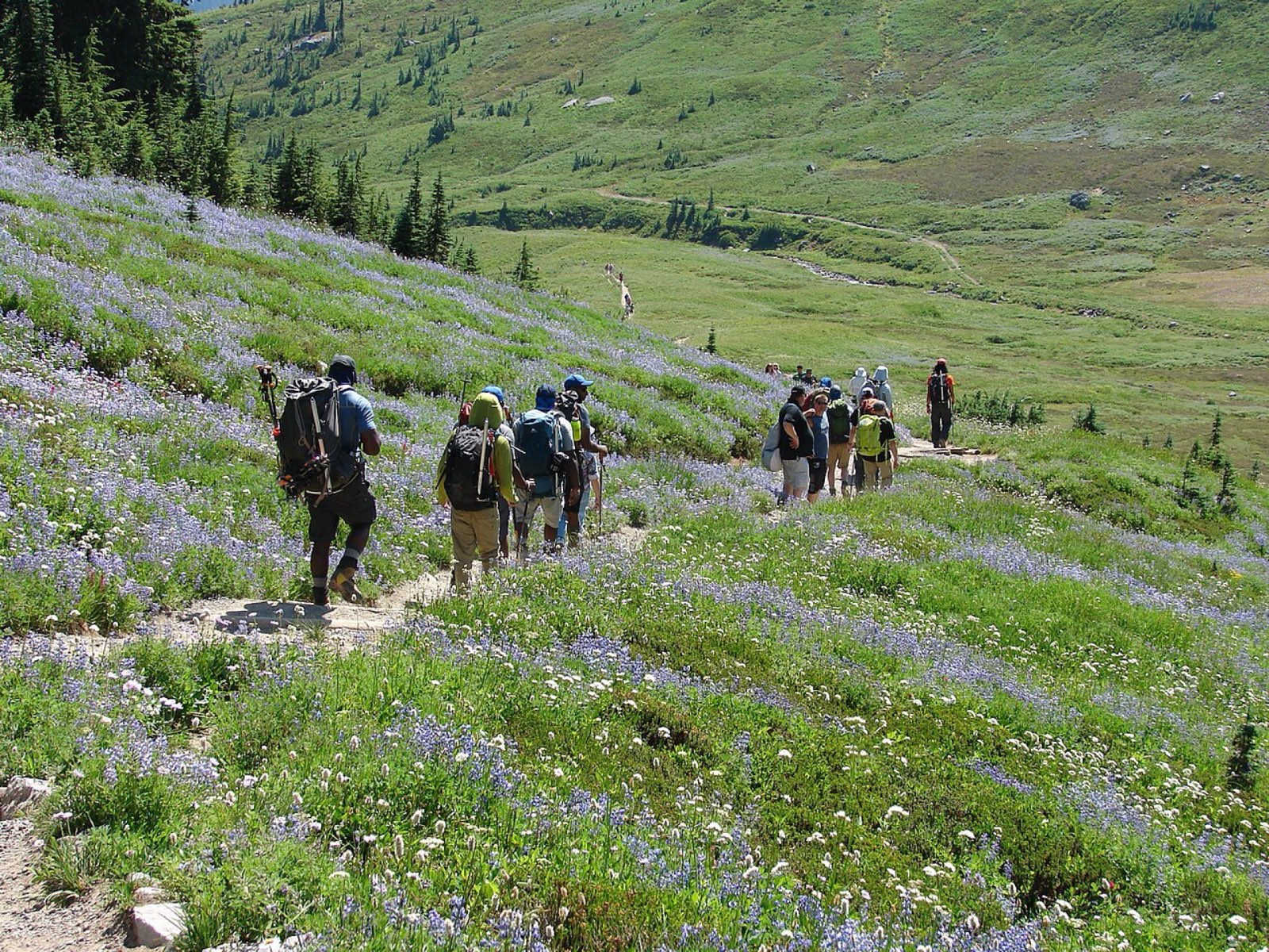
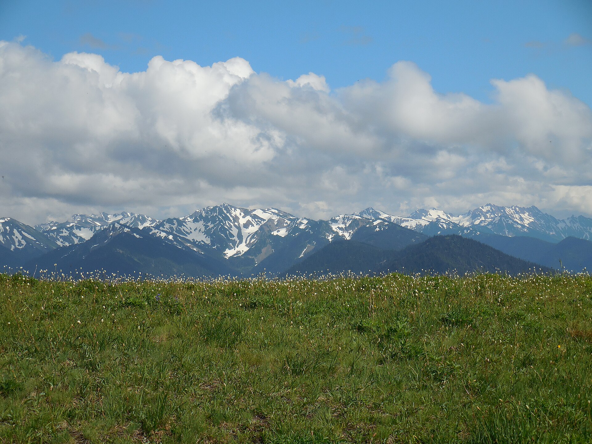
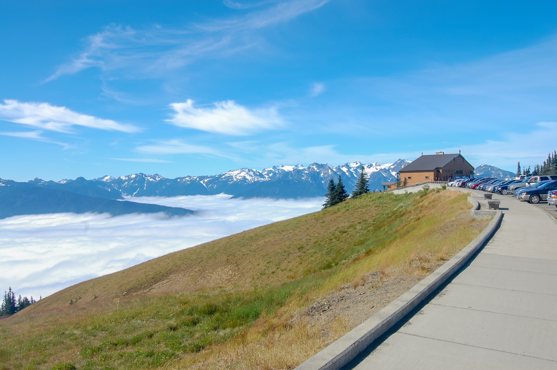
Hurricane Ridge: Alpine Trails Above 5,000 Feet
Hurricane Ridge is 17 miles south of Port Angeles on Hurricane Ridge Road, and the road itself is worth driving before you even lace up boots. It climbs from sea level through Douglas fir and subalpine forest before opening onto high meadows with unobstructed views of the Olympic peaks and the Strait of Juan de Fuca to the north.
The Hurricane Hill Trail is 3.2 miles round-trip with 700 feet of gain. The ridge narrows toward the summit. On a clear day you can see the Strait, Vancouver Island, and Mount Rainier all at once. The trailhead is at the end of the spur road past the visitor center.
Sunrise Ridge Trail runs east from the visitor center across open ridgeline terrain. It’s the better choice if you want distance without significant elevation change. The views are constant rather than saved for the end.
Timed entry reservations are required for Hurricane Ridge from late May through Labor Day. Reserve through recreation.gov, which opens the window 14 days out. Weekend slots fill within hours. The America the Beautiful annual pass covers the park entrance fee. See the Hurricane Ridge Visitor Center guide for seasonal road hours and what to expect at the facility itself.
Coastal Hiking: Rialto Beach and the Hole-in-the-Wall
The Olympic Peninsula’s coastline is one of the few places in the contiguous United States where you can hike a genuinely wild Pacific shore. No boardwalk, no paved access, no services every half mile. Sea stacks rise from the surf, tide pools form at their bases, and bald eagles are common year-round.
Rialto Beach is the most accessible starting point. The trailhead sits at the end of Mora Road, west of Forks off US-101. From the parking area, walk north 1.5 miles to the Hole-in-the-Wall, a large sea arch cut through a basalt headland. The arch is only passable at low tide, roughly below 3 feet. Check NOAA tide tables before you go. Missing the window means waiting on the beach for an hour or turning around entirely.
The full Olympic Wilderness Coast extends 73 miles from Shi Shi Beach north to the Quinault boundary south, and through-hiking it requires permits, beach camp reservations, and careful navigation of headland bypasses on inland trails during high water. The Olympic National Park visitor centers issue wilderness permits and provide current conditions reports.
The Enchanted Valley Trail
The Enchanted Valley is a glacially carved hanging valley in the Quinault watershed, on the southeast side of Olympic National Park. Reaching it requires driving to the Quinault Rain Forest and then hiking 13 miles each way on the East Fork Quinault Trail.
The trail gains about 1,100 feet over those 13 miles, a moderate grade, not a punishing one. The valley floor opens at mile 13 with waterfalls dropping off the valley walls in multiple directions and a 1930s chalet that the National Park Service maintains as a wilderness ranger station. Most people do this as a two- or three-day backpacking trip rather than a day hike.
River crossings are the main variable. The East Fork Quinault runs high through May and sometimes into early June. Several crossings are either log bridges or fords depending on the year. Check current conditions at the Quinault Rain Forest Ranger Station on the south shore road before committing to a departure day.
The Quinault area fits naturally into a longer loop of the peninsula. The Olympic Peninsula road trip itinerary maps how to combine Lake Quinault, the Enchanted Valley, and the western coast into a full seven-day drive.
Sol Duc Valley and the Falls Trail
The Sol Duc River Valley sits on the northwest side of Olympic National Park, reached via Sol Duc Road off US-101 west of Port Angeles. The road runs 12 miles into the valley to the Sol Duc Trailhead and Sol Duc Hot Springs Resort.
The Sol Duc Falls Trail is 1.6 miles round-trip with almost no elevation change, ending at one of the most-visited waterfalls in the park. The falls drop into a narrow basalt canyon that pinches to about 20 feet wide at the viewing platform, and the surrounding old-growth includes western red cedar and Douglas fir several hundred years old. Go before 9am on summer days if you want the platform to yourself.
From the falls, the Lovers Lane Trail extends 6 miles back toward the resort through old-growth forest, connecting with the short Ancient Groves Nature Trail along the way. The loop gives you a half-day of low-grade forest walking. Afterward, the Sol Duc Hot Springs pools are an easy next stop, with four soaking pools ranging in temperature from 99 to 104 degrees Fahrenheit.
Permits, Timing, and Gear
Permits and fees. Olympic National Park charges $35 per vehicle for a seven-day pass, or free with an America the Beautiful annual pass. Wilderness permits are required for all overnight backcountry camping, including the Hoh River Trail corridor, Enchanted Valley, and coastal routes. Trailhead quotas apply on some routes in summer. Reserve permits through recreation.gov starting mid-March for the summer season. Hurricane Ridge timed entry reservations are separate and sell out fast.
Best time to hike. July through September is the reliable window for most trails on the peninsula. Snow clears from Hurricane Ridge by early July. Enchanted Valley crossings stabilize after June. Coastal hiking works year-round; summer just offers longer days and fewer storms. Late October and November are a second quiet window: fall colors, far fewer visitors, and stable coastal weather before the first major storms.
Gear. The western side of the Olympic Peninsula receives more annual precipitation than almost anywhere in the lower 48. Even in July, afternoon fog and light rain are normal on the coast and in the rain forest valleys. Waterproof boots and a rain jacket are not optional. Bear canisters are required for overnight trips in the park; black bears are common throughout. For month-by-month trip planning that covers the full state, the best time to visit Washington guide has the seasonal breakdown.
Getting There and Where to Stay
Port Angeles is the practical hub for most Olympic Peninsula hiking. It’s 1.5 hours from Seattle via the Edmonds–Kingston ferry and US-101, or about 2.5 hours by driving south around Puget Sound. Hurricane Ridge Road, the Hoh Visitor Center, and Sol Duc Road are all within an hour of Port Angeles.
For the southern zones (Enchanted Valley, Lake Quinault, and the southern coast), Lake Quinault Lodge is the better base. The 1926 lodge sits on the lake’s south shore, 3 hours from Seattle via I-5 south to US-101 north. No cell service. The old-growth forest starts at the parking lot.
Campgrounds across the peninsula fill in summer. Reserve through recreation.gov as early as possible. The Olympic National Park camping guide covers every campground zone from the Hoh to the Pacific coast, with specifics on which sites require reservations and which remain first-come, first-served.