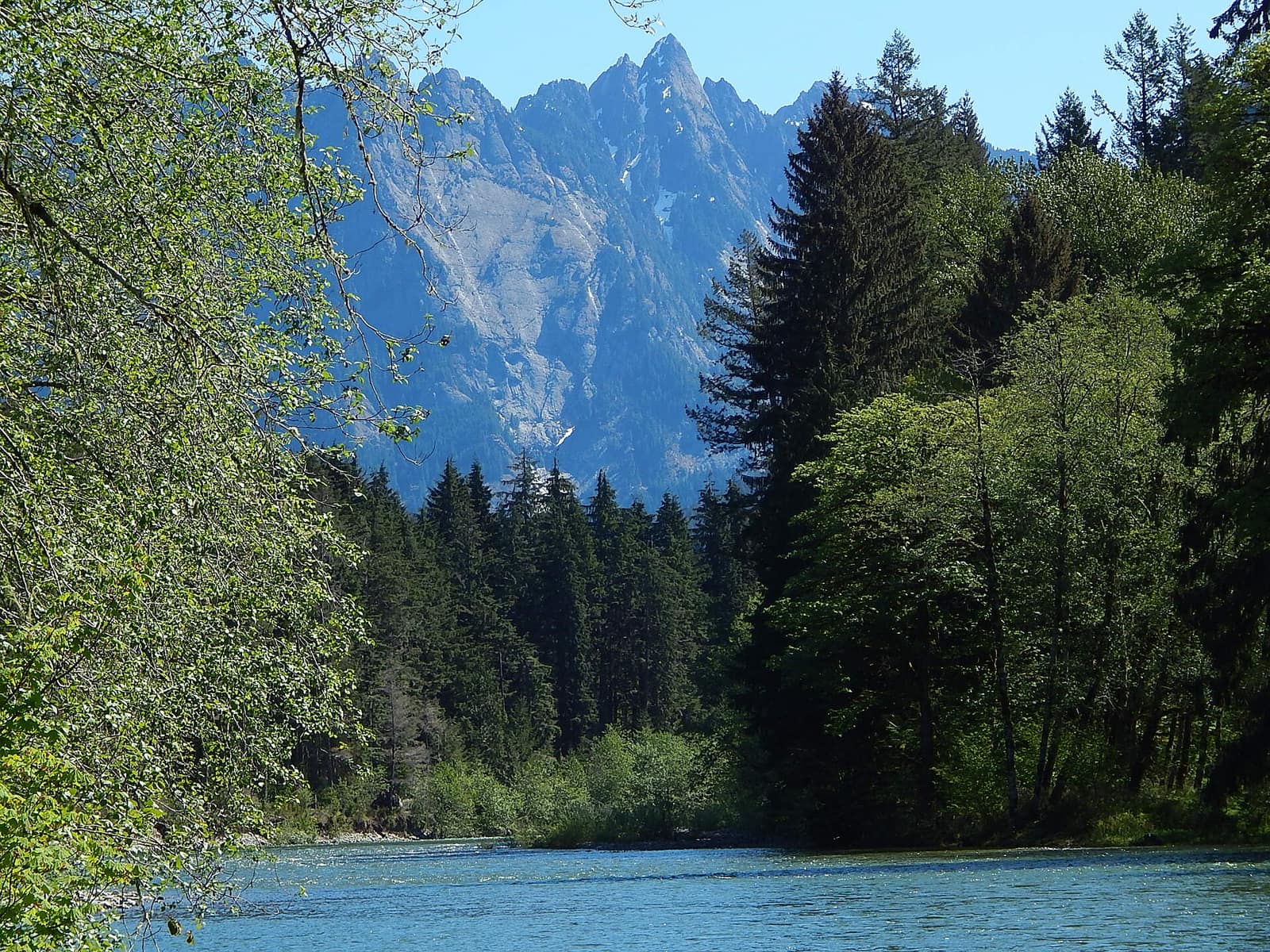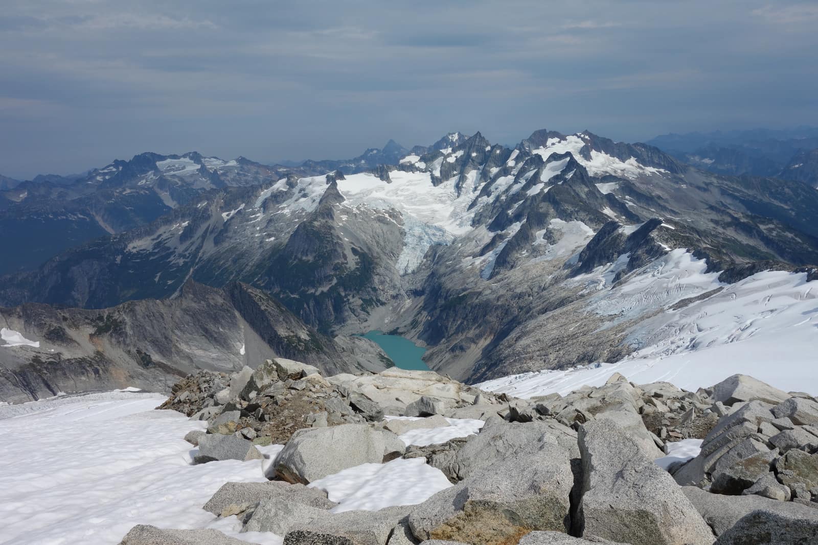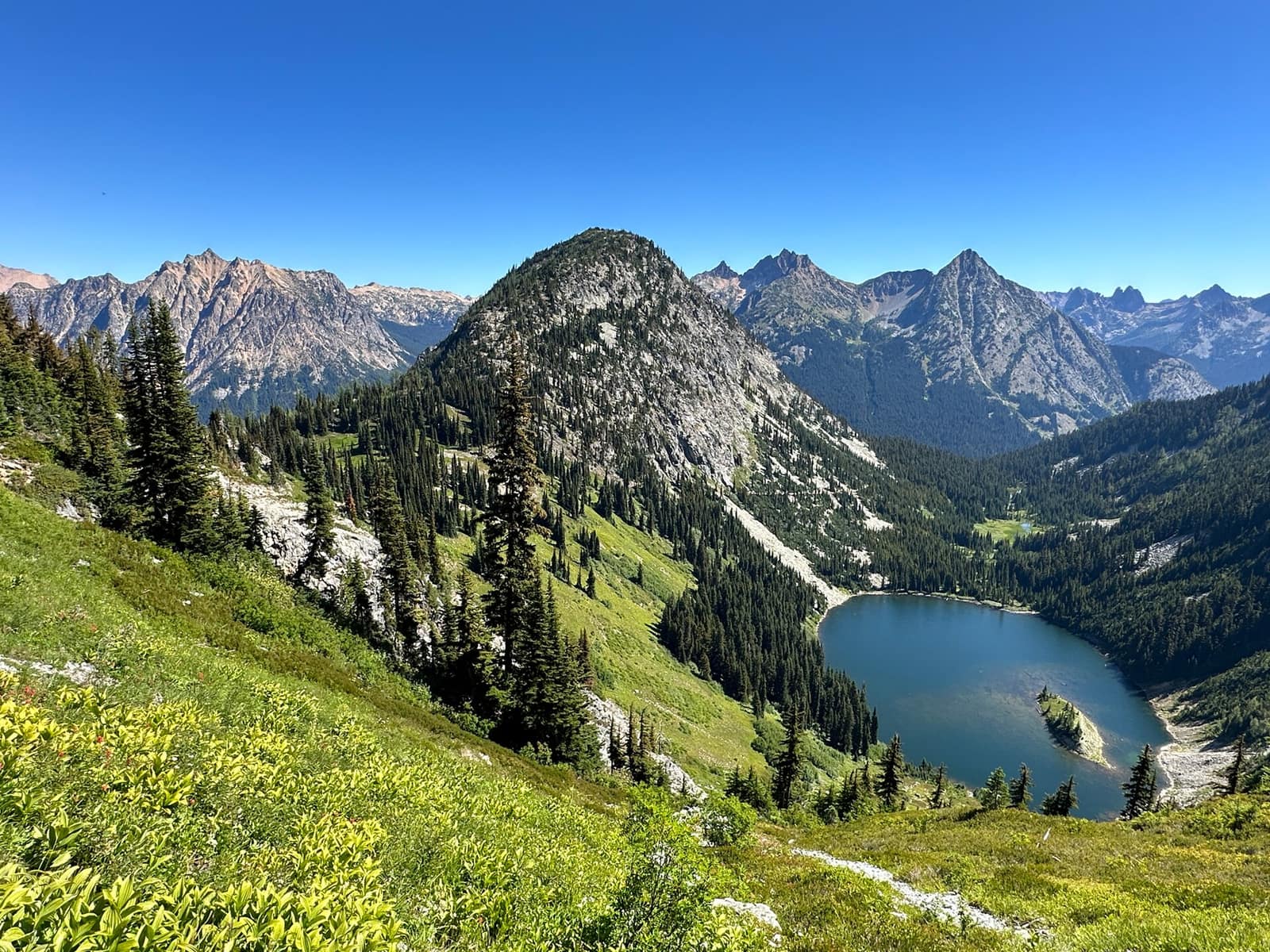
The North Cascades earn their nickname. The American Alps rise from the Skagit Valley floor in a tangle of glaciated ridgelines, with waterfalls streaming off every cliff face and valleys so remote that black bears outnumber day hikers on most weekday mornings. Hiking North Cascades Washington style means choosing from more than 400 miles of maintained trail: easy lakeside walks with turquoise water below your boots, or multi-day ridge traverses with no cell signal and no crowds. This guide covers eight trails that give first-time visitors a real picture of the park without requiring a week of leave.
Why the North Cascades Hit Differently
Most national parks have one iconic viewpoint. The North Cascades National Park Complex has dozens, and relatively few people have seen any of them. Compared to Mount Rainier (which draws day hikers from across the Pacific Northwest to well-paved trailheads), the North Cascades operate at a different frequency. The main corridor through the park, Highway 20 (North Cascades Highway), closes from mid-November through late spring under avalanche threat. There are no lodges inside the park boundaries. That inaccessibility is the whole point.
The complex encompasses three units: North Cascades National Park proper (the wilderness core), and the Ross Lake and Lake Chelan National Recreation Areas flanking it to the north and southeast. What most visitors call the “North Cascades” includes surrounding national forest land: Maple Pass Loop and Chain Lakes Loop, two of the best-known trails in the area, technically sit inside Okanogan-Wenatchee and Mt. Baker-Snoqualmie National Forests. None of that matters when you’re standing on a ridgeline with a ring of jagged peaks in every direction.
Wildlife density here is higher than almost anywhere else in the lower 48. Grizzly bears are occasionally confirmed in the Cascades ecosystem. Mountain goats frequent the high ridges. Wolverines den in the remote north. Carry bear spray on any trail above treeline and know how to use it.
Maple Pass Loop: The One Everybody Talks About
Distance: 7 miles | Elevation gain: 2,090 ft | Difficulty: Moderate-strenuous
Maple Pass Loop starts from the Rainy Pass Picnic Area on Highway 20, about 53 miles east of Marblemount. The loop climbs through old-growth forest on one side and traverses an open ridgeline with views down to Lake Ann and Rainy Lake on the other. In late September and early October, the surrounding larches turn gold against gray granite peaks, making this one of the most photographed places in Washington State.
Go counterclockwise: climb the south ridge first, cover the exposed section while your legs are fresh, then descend through the forest. The ridgeline between Maple Pass and Lewis Lake sits above 6,800 feet with no shade or shelter. Bring a wind layer even in August.
Parking at Rainy Pass fills completely by 8am on weekends from July through October. The lot also serves the Rainy Lake Trail: 2 miles round-trip, flat, paved, good for families with young children. If you’re driving from Seattle, leave by 5am or add an overnight in Winthrop or Mazama.
Diablo Lake Trail: Turquoise Water, Modest Miles
Distance: 3.8 miles to Thunder Knob overlook (7.6 miles out-and-back to summit) | Elevation gain: 440 ft to overlook | Difficulty: Easy-moderate
Diablo Lake sits inside the Ross Lake National Recreation Area, dammed in 1930 by Seattle City Light. Glacial flour suspended in the water gives it a color that genuinely looks tropical against the surrounding granite walls. The Diablo Lake Trail starts from Colonial Creek Campground on Highway 20 and climbs gradually to the Thunder Knob overlook at mile 1.9, where the lake stretches below between Colonial Peak and Davis Peak.
Thunder Knob summit adds another 1.9 miles each way and 650 feet of gain, with a full view of the lake’s turquoise expanse and Pyramid Peak closing off the western end. This is one of the better options if you want real elevation views without committing to a full-day push.
The trailhead is free to access and requires no day-use permit. Colonial Creek Campground serves as a base for backpackers heading into the park interior. For anyone curious what wilderness camping looks like in a more rugged NPS setting, this stretch of the park gives a good preview.
Blue Lake Trail: High Basin, Early Wildflowers
Distance: 4.2 miles round-trip | Elevation gain: 1,050 ft | Difficulty: Moderate
Blue Lake gets overshadowed by Maple Pass Loop, which leaves the trailhead quieter even though both start from the same stretch of Highway 20. The Blue Lake trailhead is at Washington Pass overlook parking, not Rainy Pass. The trail passes through subalpine fir and Engelmann spruce before opening onto a granite basin. Blue Lake itself sits at 6,254 feet, ringed by Liberty Bell Mountain on one side and the Early Winters Spires on the other.
Peak wildflower bloom runs mid-July through early August. The basin holds patches of heather, paintbrush, and avalanche lily depending on where the snowpack cleared. The south-facing approach melts out faster than the shadier Maple Pass ridge, so this is often one of the first trails in the area to come into shape after a big snow year.
Chain Lakes Loop: Two Volcanoes and Four Lakes
Distance: 6.5 miles | Elevation gain: 1,740 ft | Difficulty: Moderate
Chain Lakes Loop sits northwest of the main North Cascades National Park in the Mt. Baker-Snoqualmie National Forest, but it belongs on any North Cascades hiking list. Starting from Artist Point at the end of State Route 542 (Mt. Baker Highway), the trail circles through four small lakes with unobstructed views of Mt. Baker’s Coleman Glacier and Mt. Shuksan to the east. On a clear day the contrast between the two peaks (Baker’s ice dome and Shuksan’s fractured rock pyramid) is striking from every angle on the loop.
Artist Point sits at 5,140 feet, so you start the hike already above treeline. The route passes Mazama Lake, Hayes Lake, Iceberg Lake, and Arbuthnot Lake in sequence. Go clockwise to ascend via the open ridgeline and descend through the forest. Artist Point typically doesn’t open until mid-July due to snowpack. Check current road conditions with the Mt. Baker Ranger District before making the drive.
This basin is one of Washington’s best places to watch autumn unfold through the landscape: the heather turns rust and orange in September, the larches go gold, and crowds thin sharply after Labor Day.
Cascade Pass and Sahale Arm: The Route Serious Hikers Plan Around
Distance: 3.7 miles to Cascade Pass; 12.2 miles round-trip to Sahale Glacier Camp | Elevation gain: 1,800 ft to pass; 3,800 ft to glacier camp | Difficulty: Moderate to Cascade Pass; strenuous for Sahale Arm
Cascade Pass is the gateway to some of the most dramatic terrain in the park. Starting from the Cascade River Road trailhead (23 miles up a dead-end road from Marblemount), the trail climbs 1,800 feet in 3.7 miles through switchbacks to a broad saddle at 5,392 feet. The view from the pass looks down the Stehekin Valley to the southeast and back down the Cascade River drainage to the northwest.
From the pass, Sahale Arm continues climbing another 2,000 feet of open tundra and rock to the edge of the Sahale Glacier at 7,600 feet. The summit camp looks out over Boston Glacier, Forbidden Peak, and a chain of ridgelines extending north toward Canada. This is the trail you do when you want to understand what the interior of the range looks like.
Backcountry permits are required for overnight stays at Sahale Glacier Camp. Day hikers do not need a permit. Reservations open at recreation.gov in March and fill within hours of release. The Cascade River Road may have rough sections requiring slow driving in the final miles.
Thunder Creek Trail: Valley Depth and Old Growth
Distance: Up to 33 miles one way (most day hikers turn around at 4-6 miles) | Elevation gain: Minimal for first 6 miles | Difficulty: Easy
Thunder Creek Trail starts from Colonial Creek Campground and follows the creek through old-growth forest with almost no elevation change for the first several miles. Western red cedar and Douglas fir at this elevation are massive, with some trunks over 6 feet in diameter. This is the trail for people who want to feel the scale of the forest rather than the scale of the mountains.
Day hikers typically walk 2-3 miles to the first good viewpoints near the gorge section, then turn around. The full trail extends 33 miles into the park interior to Park Creek Pass at 6,040 feet, making it a serious multi-day route for backpackers who plan well ahead for permits.
Planning Your Hiking Trip to the North Cascades
The best window for visiting Washington for alpine hiking is July through mid-October, and the North Cascades follow that rule closely. Highway 20 closes at milepost 134 near Early Winters Campground around mid-November and typically reopens in late April. Check current road status with WSDOT’s pass report page before any trip with a late-season question mark.
From Seattle: Marblemount is about 2 hours (105 miles) via I-5 North to State Route 20 East. The North Cascades Visitor Center is in Newhalem, 14 miles past Marblemount, and has ranger staff, trail condition updates, and bear canister rentals. For trails near Maple Pass and Washington Pass, Winthrop (on the Methow Valley side) is 3 hours from Seattle and the better base.
Permits: Day hiking requires no permit at most trailheads. Backcountry camping permits are required May 15 through October 31 for designated sites and must be reserved in advance at recreation.gov. A Discover Pass is required at some trailheads within adjacent Washington State forest land; check individual trailhead requirements before you go.
Gear for the elevation: Even in July, temperatures above 6,000 feet can drop quickly when marine air pushes in from the coast. Pack a wind layer, a rain jacket, and at least 3 liters of water. Bear canisters are required for backcountry travel in designated wilderness areas and available for rent at the Wilderness Information Center in Marblemount.
The North Cascades are not a park you visit once and feel like you’ve covered. Most people who go come back the next year planning to stay longer.
Hero photo: Maple Pass at North Cascades in WA by jhvanwa, licensed CC0, via Wikimedia Commons. Resized.