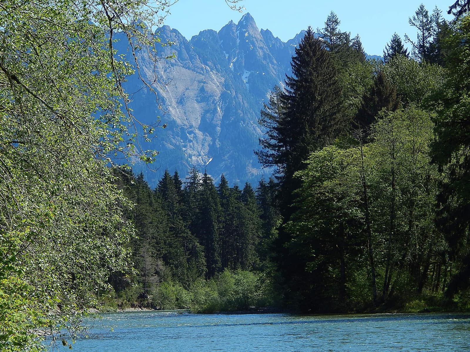
The approach to Washington Pass gives no warning. You’re threading through a Douglas fir corridor, the Skagit River dropping away in the canyon below, and then the road curves and the peaks appear: Liberty Bell Mountain and the Early Winters Spires, sheer granite faces rising two thousand feet above the valley floor. It happens fast. Passengers stop mid-sentence.
This is what the North Cascades Highway was built to reach. Washington State Route 20 cuts across the top of the state from the Puget Sound basin to the semi-arid Methow Valley. The section worth planning a trip around covers about 80 miles between Marblemount and Winthrop, crossing two mountain passes and skirting three glacially-fed reservoirs in a single afternoon’s drive.
Route Basics: The Drive from West to East
The western starting point for most visitors is Burlington, about 65 miles north of Seattle. From there, SR-20 follows the Skagit River upstream through Concrete and Marblemount before entering the national park. East of the park, the road drops into the Methow Valley and runs through Mazama and Winthrop before continuing toward Spokane.
The scenic core is Marblemount to Winthrop: 80 miles, two passes, and a climb to 5,477 feet at Washington Pass. Without stops, it’s about two and a half hours. With the overlooks and short hikes you’ll want to make, budget five to six hours. The North Cascades National Park visitor area straddles the highway through most of this stretch.
The road closes annually, usually around mid-November, and reopens in mid-April. The Washington State Department of Transportation posts conditions and the official opening date at wsdot.wa.gov. Check it before driving in spring or fall.
Starting from the West: Marblemount and Newhalem
Sedro-Woolley, about 15 miles east of Burlington, is where you’ll find grocery stores and gas stations before the terrain gets serious. Stock the cooler here if you’re camping. From Sedro-Woolley, the highway passes through Concrete, a small town named for the Portland Cement Company that operated here in the early 1900s, before reaching Marblemount.
Marblemount is the last reliable gas before the park. Fill up regardless of your gauge. The next stations are in Mazama, about 80 miles east. Marblemount also has a general store and a burger spot. The Cascade River Road branches south here, leading to the trailhead for Cascade Pass, one of the park’s best day hikes.
Newhalem, 12 miles east of Marblemount, is a Seattle City Light company town built to house workers for the Skagit River hydroelectric dams. The North Cascades Visitor Center sits here and is worth stopping for current trail and campground conditions. Rangers can tell you whether any trails are flooded or whether snow is still blocking the higher passes. Newhalem Creek Campground, operated by the National Park Service, has tent and RV sites bookable through Recreation.gov.
Two short walks start near Newhalem. The Trail of the Cedars is a flat 0.3-mile loop through old-growth cedar along the river. Ladder Creek Falls is slightly longer and more interesting: the falls are illuminated by colored lights after dark in summer, a Seattle City Light tradition since the 1930s.
Diablo Lake: The Turquoise Water Explained
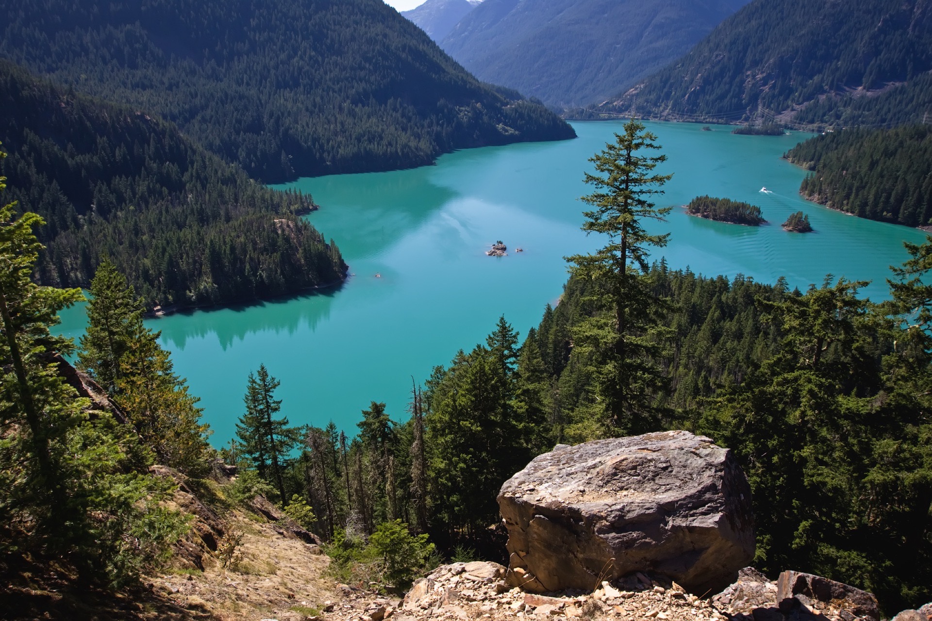
About six miles east of Newhalem, the Diablo Lake Overlook is a roadside pull-out that stops nearly every passing driver. The lake runs jade-to-turquoise depending on the time of day and the season, the product of glacial flour: fine particles of rock ground off the surrounding peaks and suspended in meltwater flowing down from active glaciers. The color deepens as summer snowmelt peaks in July and August.
Photographers get good saturation around midday. Late afternoon pulls warmer tones across Colonial Peak and Pyramid Mountain to the south. Either works.
The Diablo Lake Trail runs 7.6 miles along the lake’s north shore, starting from Colonial Creek Campground at Thunder Arm. This campground has some of the best lakeside sites on the highway. The trail is moderately difficult, gains about 1,000 feet total, and gives multiple angles of the water from different elevations. It’s a solid half-day option for anyone who wants more than an overlook stop.
Ross Lake, the larger reservoir immediately north, stretches 24 miles into British Columbia. There’s no road access from the highway. Ross Lake Resort operates a floating lodge accessible only by a steep trail and a small barge from Diablo. It books out months in advance.
For a full look at hiking inside the park, including the Cascade Pass and Sahale Arm routes, see our guide to things to do in North Cascades National Park.
Washington Pass Overlook: Where the Highway Earns Its Name
Washington Pass sits at 5,477 feet, 27 miles east of Newhalem. The overlook parking area is on the south side of the road. Walk 0.2 miles from your car and the view opens onto Liberty Bell Mountain and the Early Winters Spires, vertical granite walls above the Early Winters Creek drainage. On a clear afternoon, the light on those faces is the kind of thing passengers try to photograph and fail to capture adequately.
The parking lot fills by mid-morning on summer weekends. Arriving before 9 a.m. or after 5 p.m. keeps the worst of the crowds out of your way.
Two trailheads start near the pass. The Blue Lake Trail begins about 0.5 miles west of the summit and climbs 2.2 miles to a small alpine lake at the base of Liberty Bell. Snow can block the trailhead well into June; check conditions before you go.
Rainy Pass is four miles west of Washington Pass at 4,855 feet. The Maple Pass Loop starts here: 6.8 miles, 2,000 feet of gain, and a ridgeline crest at 6,600 feet with views across Lake Ann and the Lewis Lake basin below. This is one of the most consistently praised day hikes in Washington, and for good reason. The route takes about four hours at a moderate pace.
For fall color, the last two weeks of September are the typical peak window: alpine larches turn gold in the high basins, and the meadows along the loop go amber. If you’re doing one hike along the entire highway, Maple Pass Loop is it.
Descending East: Mazama and Winthrop
East of Washington Pass, the temperature climbs and the trees thin. By Mazama, 12 miles from the summit, the conifers have shifted from hemlock and silver fir to ponderosa pine. The Mazama Store is a general store with a solid deli and the first reliable food stop since Newhalem. The Mazama Country Inn nearby is a good overnight if you want to break the drive.
From Mazama it’s 15 miles to Winthrop. The town rebuilt itself with a Western frontier aesthetic in the 1970s: boardwalks, false fronts, and a main street built for foot traffic. It works better than it sounds. The Winthrop Brewing Company serves chili and local beers in a main-street space that fills with hikers and cyclists on summer afternoons. Arrowleaf Bistro, a block off the main drag, does more serious cooking: Pacific Northwest-focused food using local meat and produce.
Sun Mountain Lodge sits nine miles south of Winthrop via Twin Lakes Road. The dining room has views across the Methow Valley that run long. The lodge connects to the Methow Valley trail system, which has more than 200 kilometers of cross-country ski and mountain bike trails. Summer weekends fill quickly; book two to three weeks ahead for July and August stays.
If you’re making a loop rather than a straight crossing, Leavenworth is about 90 miles south via US-97 and US-2. See our guide to things to do in Leavenworth for what’s there.
When to Drive the North Cascades Highway
The road is open roughly late April through mid-November, with reliable full conditions running mid-May through mid-October. Both passes must be clear and WSDOT must have removed avalanche debris before the road officially opens each spring.
Summer weekends are the busiest period. If you can drive Tuesday through Thursday, the overlooks at Diablo Lake and Washington Pass are far more accessible.
September is the strongest month for a first-time trip. Crowds thin after Labor Day, temperatures stay comfortable in the 60s in the valley and 40s at the passes, and the alpine larches at Rainy Pass and Washington Pass begin turning gold in the second and third weeks of the month. Snow at Washington Pass can arrive by mid-October.
For a broader look at seasonal conditions around the state, see our guide on the best time to visit Washington State.
Practical Planning
Gas: Fill up in Sedro-Woolley or Marblemount coming from the west, and in Mazama or Winthrop coming from the east. There are no stations in the park.
Cell service: Essentially absent between Marblemount and Mazama. Download offline maps in Google Maps or Gaia GPS before you leave the highway’s western end.
Drive time: Marblemount to Winthrop is 2.5 hours nonstop. With the Diablo Lake overlook, Washington Pass, and a stop at Rainy Pass, plan five to six hours.
Camping: Newhalem Creek and Colonial Creek campgrounds are the main NPS sites along the highway, both bookable through Recreation.gov. Lone Fir Campground (Forest Service) is first-come, first-served near Washington Pass on the eastern slope. For the full breakdown on park campgrounds and backcountry permits, see our North Cascades camping guide.
Overnight in Winthrop: Sun Mountain Lodge and the Duck Brand Hotel are the best-known options. Budget motels cluster along the main highway. Book in advance for any summer weekend.
What to bring: Layers at every elevation. Even in August, Washington Pass and Rainy Pass run 15 to 25 degrees cooler than the Methow Valley floor. Bring water and snacks for the park section, where no services exist between Newhalem and Mazama.