Larch hikes in Washington happen during a narrow window. Alpine larches turn from green to gold over about two to three weeks, typically running mid-September through mid-October depending on elevation and how early fall comes that year. Arrive too early and the color hasn’t arrived. Wait too long and the needles have dropped. Get the dates right and you’ll be standing in some of the most distinct fall color in the Pacific Northwest, 6,000 feet up on a clear October morning.
The trees grow only in the high alpine zone. That means steep approaches, rocky terrain, and temperatures that run 15 to 25 degrees cooler than the valley floor below. Morning frost on the rocky ridges is common by late September. Come prepared to hike uphill.
Washington’s best larch hikes concentrate in two areas: the North Cascades along State Route 20, and the Alpine Lakes Wilderness east of Leavenworth. The following five routes are the ones that consistently deliver the best color and the clearest views.
Why Alpine Larches Are Different
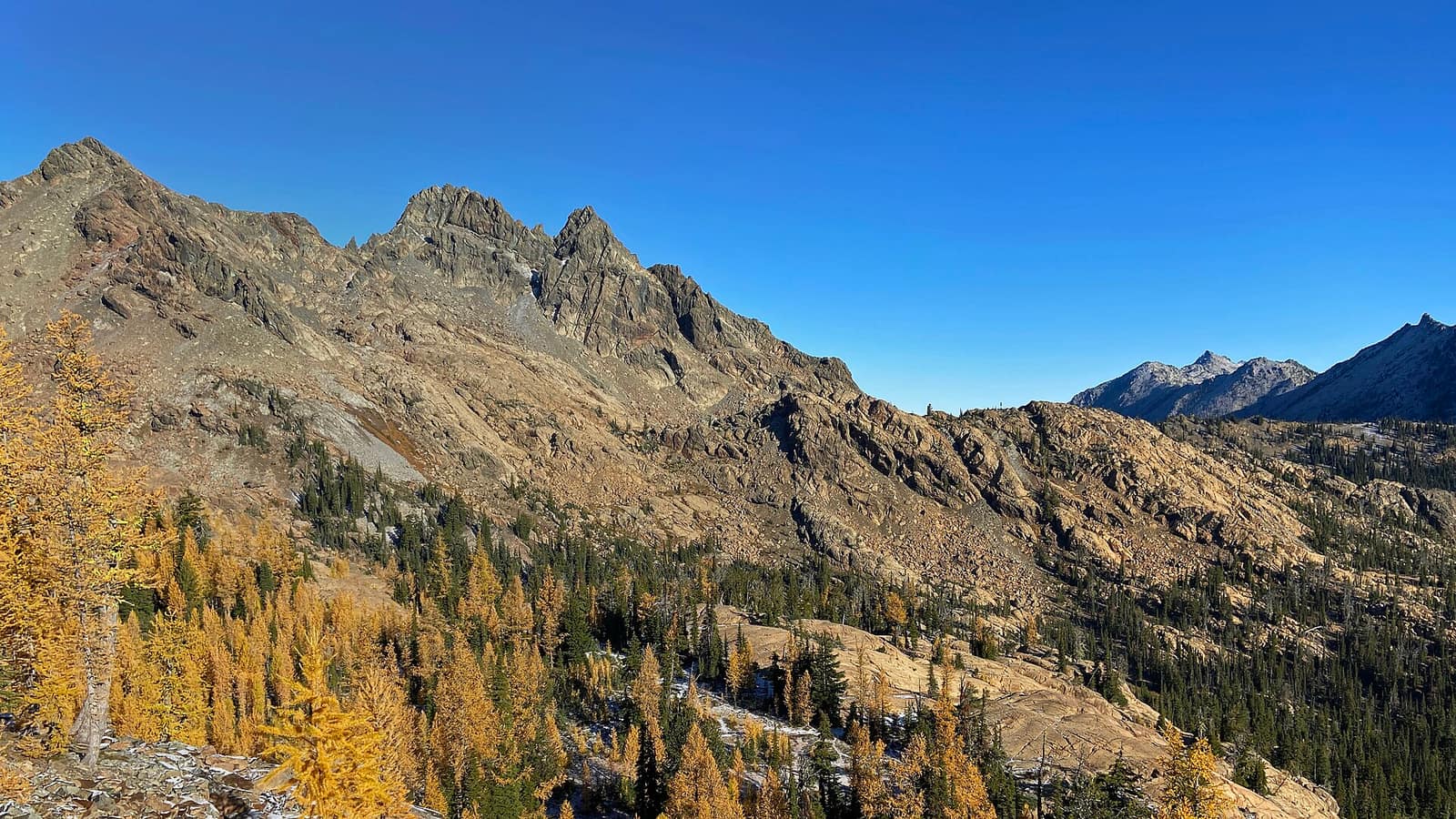
Alpine larches (Larix lyallii) are the only deciduous conifer native to Washington’s high country. Every other conifer here holds its needles year-round. The larch drops them each fall, but before it does, those needles go amber-gold, a warm saturated color that sits against granite and blue October sky in a way that evergreen slopes don’t. The contrast is part of what makes larch season worth planning around. Green hillsides frame the gold groves, and above the larches, bare rock and the first snowfall of the season often complete the picture.
The trees are slow-growing. A larch with a trunk a foot in diameter may be 500 years old. They grow in the boulder fields and rocky basins where cold air pools, soil barely accumulates, and snow can persist into July. That’s why finding them requires a real hike: the terrain they occupy doesn’t make concessions.
Maple Pass Loop: The Benchmark Larch Hike
The Maple Pass Loop starts at the Rainy Pass trailhead on Highway 20, about 50 miles east of Marblemount. The route is 6.8 miles with about 2,000 feet of gain, and the upper section runs along a ridgeline at 6,600 feet with larches filling the basins on both sides. Lake Ann sits in the cirque below to the north. The Lewis Lake basin drops away to the south. On a clear September day the views extend across multiple drainages of the North Cascades.
Most hikers run the loop counterclockwise, climbing the northwest ridge first and descending the main trail back to Rainy Pass. This puts the best views ahead of you on the way up and saves the steepest pitches for descent. The upper ridgeline section takes about 45 minutes to traverse and is where the larch color concentrates most densely.
The route is well-maintained but rocky above tree line. Snow can linger on north-facing slopes into July; by late October the same slopes freeze solid by morning. Microspikes are worth carrying if you’re hiking after mid-October.
The Rainy Pass lot fills by 8 a.m. on September weekends. Arrive before 7:30 or plan to park on the highway shoulder. A Northwest Forest Pass or America the Beautiful Pass is required.
The Rainy Pass trailhead sits on the same stretch of highway as Diablo Lake and Washington Pass. For the full drive context, see our North Cascades Highway guide.
Ingalls Lake and Ingalls Pass: Central Cascades Gold
The Ingalls Lake Trail is the central Cascades counterpart to Maple Pass: longer approach, bigger larch basin at the top, and a permit system that limits the day-use crowds somewhat. The trailhead is at the Esmeralda Basin parking area, about 30 minutes east of Leavenworth via US-97 and Forest Road 9737.
The full trip to Ingalls Lake is 9 miles roundtrip with 2,800 feet of gain. The lake sits at 6,463 feet in the Alpine Lakes Wilderness, rimmed by granite walls and larch groves. Ingalls Pass, a quarter mile above the lake, adds 400 more feet and opens a view north into the Stuart Range. Mount Stuart’s north face, a sheer 9,415-foot wall of rock, dominates the skyline from the pass. First-time visitors tend to stop there and look for a while.
Permits: A Stuart-Ingalls Day Use Permit is required for day hikers visiting the area during peak season, generally July 1 through October 15. Book through Recreation.gov when permits open in spring; they sell out within hours of release. A small number of walk-up permits are released each morning at the Leavenworth Ranger Station.
Base yourself in Leavenworth the night before and drive up early. For what else is worth doing there, see our Leavenworth guide.
Cutthroat Pass: A Quieter SR-20 Alternative
Cutthroat Pass sits in the shadow of Maple Pass’s reputation, which means you can sometimes still find a parking spot on a September weekend. The trailhead is on Highway 20 about two miles east of the Rainy Pass lot, and the route climbs 11.6 miles roundtrip to the pass at 6,820 feet.
The upper basin holds a cluster of larches between 6,200 and 6,600 feet on the north-facing slopes. From the pass, the view runs north into Early Winters Creek and south toward Cutthroat Lake, a shorter larch destination reachable from the same parking area on a 4-mile out-and-back with only 500 feet of gain.
The Cutthroat Lake option is the easier pick: 4 miles roundtrip, manageable gain, and a small lake ringed with larches that photographs well in the morning light. A Northwest Forest Pass or America the Beautiful Pass is required at both trailheads. For a fuller look at what the region offers beyond the highway corridor, the North Cascades National Park guide covers the park’s hiking, visitor centers, and camping in detail.
Hart’s Pass: Larch Meadows Without the Big Climb
Hart’s Pass sits at 6,198 feet and is the highest point in Washington accessible by road. The pass is about 50 miles from Winthrop via a narrow, partially unpaved route (no trailers or RVs), but the payoff is arriving at elevation rather than hiking to it.
A short walk from the Slate Peak parking area reaches the former fire lookout site at 7,440 feet, where larches grow in scattered clusters along the approach. The trail is under 2 miles roundtrip with about 500 feet of gain. From the lookout, the Pasayten Wilderness stretches north into British Columbia, and the meadows below the summit show well in late September.
The pass road typically closes in late October. Check Okanogan-Wenatchee National Forest conditions before making the drive. The larch concentration here is lighter than at Ingalls or Maple Pass, so this works better as a first introduction or a complement to another destination than as the primary reason for a trip. The easy access is real, though.
Larch Lakes Loop: The Multi-Day Option
The Larch Lakes Loop is a 21-mile route in the Entiat Wilderness, southeast of Chelan in Okanogan-Wenatchee National Forest. The route visits Lower and Upper Larch Lake, both set in a basin around 6,400 feet, with larches covering the slopes above Upper Larch Lake in a display that rivals the more traveled Cascades sites.
Most visitors take two nights: one at each lake. The trailhead is in the Phelps Creek area and involves a long drive on Forest Road 5900 from Entiat, plus significant gain before you reach the lakes.
No overnight permit is required, but Leave No Trace standards are enforced and camping near the shorelines is restricted. This is a genuine wilderness route: bring navigation tools, a water filter, and emergency layers. The Washington Trails Association posts current trip reports in season; search for Larch Lakes before you commit to a date. The Entiat Mountains see far fewer visitors than the SR-20 corridor, and Upper Larch Lake remains one of the quieter places to see fall color in the state.
Timing, Crowds, and Practical Planning
When to go: Peak larch color in Washington typically falls in the last ten days of September through the first week of October at elevations above 6,500 feet. Lower-elevation stands lag by about a week. A light frost accelerates the color turn; a hard windstorm can strip the needles before peak.
Washington Trails Association’s trip reports are the fastest way to know what’s happening on the ground right now. Search the specific trail name starting in mid-September. Hikers post updates within days of current conditions.
Crowds: Maple Pass is the most visited larch hike in the state. Cutthroat Pass and Hart’s Pass are noticeably less busy. Ingalls Lake has a daily permit cap. Larch Lakes Loop draws the fewest visitors of any route listed here.
Weather: October in the high Cascades can bring snow, wind, and reduced visibility on short notice. The summit elevations on these routes (6,500 to 7,400 feet) are materially different from the trailhead parking lots. Bring layers, check the forecast the night before, and tell someone your itinerary.
Getting there: The SR-20 trailheads are about 3 hours from Seattle. The Ingalls Lake trailhead is about 2 hours 45 minutes, with Leavenworth the natural overnight base. For a broader look at fall outdoor activities around the state, see outdoor activities in Washington and our guide to the best time to visit Washington State.
Hero photo: Ingalls Pass at Alpine Lakes Wilderness by Jeffhollett, licensed CC BY-SA 4.0, via Wikimedia Commons. Resized.