The drive across the Deception Pass Bridge stops most first-time visitors cold. Two steel arch spans cross a narrow tidal channel 180 feet above the water, and on both sides the current tears through the gap with enough force to churn whitecaps even on calm mornings. Washington’s most visited state park stretches across the northern tip of Whidbey Island and a section of Fidalgo Island, covering more than 4,000 acres of old-growth forest, rocky headlands, and sand beaches. If you’re planning any part of a Washington trip through the Puget Sound corridor, Deception Pass belongs on the itinerary.
What Makes Deception Pass State Park Worth the Visit
The park draws more than 2 million visitors per year, putting it on par with many national parks in terms of raw attendance. What makes that number credible is that there’s no single thing pulling people in. The bridge itself is a spectacle, but there are also three distinct beaches, more than 38 miles of trail, multiple campgrounds, sheltered inlets for kayaking, and tide pools exposed twice a day by a 10-foot tidal swing.
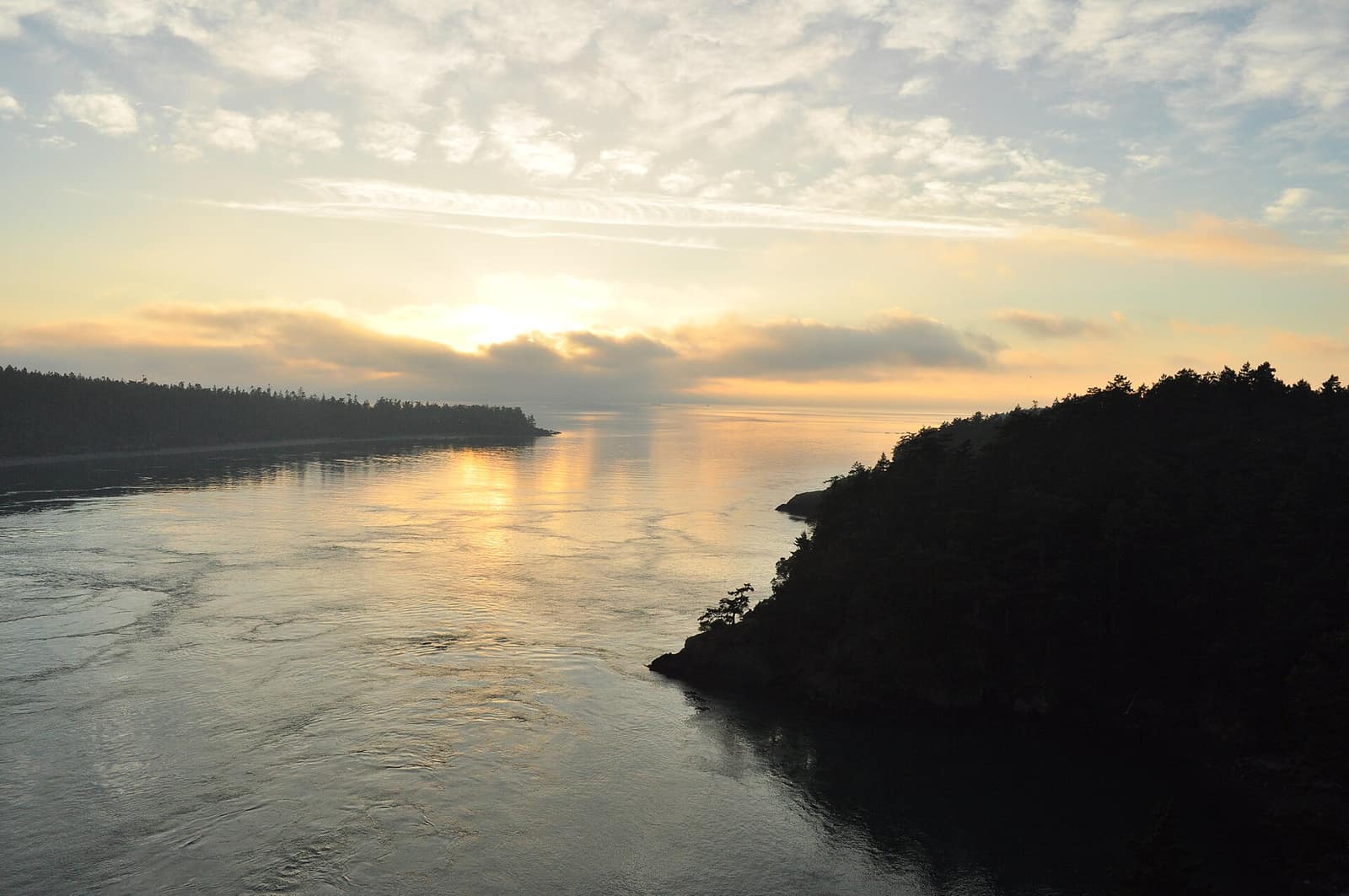
The geography explains the drama. Deception Pass is the narrow channel that separates Whidbey Island from Fidalgo Island, and the water doesn’t just flow through it. It surges. At peak tidal exchange, the current runs at up to 9 knots, generating standing waves and whirlpools visible from the bridge overlook. British navigator George Vancouver named the pass in 1792 after realizing the channel he’d initially mapped as a river was actually open water on both ends, deceiving his earlier survey.
The Civilian Conservation Corps built the bridge in 1935, connecting the two islands with a pair of arched spans using Pass Island as a midpoint. It’s now listed on the National Register of Historic Places and has become one of the most photographed structures in Washington State.
Entry to the park requires a Washington State Discover Pass ($10/day or $35/year), available at park entrance booths or at discoverpass.wa.gov.
Hiking at Deception Pass
The trail network branches from multiple trailheads and covers enough varied terrain that you won’t run out of options even on a long visit.
Goose Rock Perimeter Trail
The standout hike follows the Goose Rock Perimeter Trail, a loop of roughly 3 miles around the summit of Goose Rock, the park’s highest point at 484 feet. The trail is classified as moderate, with switchbacks through Douglas fir and western red cedar before emerging onto exposed rock near the summit. From the top, the views take in the pass directly below, the San Juan Islands spread to the north, the Olympic Mountains across the water to the southwest, and Mount Baker rising to the northeast on clear days. Start from the parking area just east of the north bridge span to access the trailhead without crossing busy highway 20.
Give yourself two to three hours for the loop if you stop at the summit, which is worth doing. Early mornings before 9am offer the quietest conditions and the best light for photography.
Forest Loop and North Beach
For something less demanding, the Forest Loop Trail threads through stands of old-growth Douglas fir, shore pine, and western red cedar. It connects naturally to the North Beach area, which makes it a good choice if you want to combine a forest walk with a beach stop in a single route. The loop distance varies depending on which connectors you take but most people cover 2 to 3 miles. This is also the easiest trail to navigate with younger kids.
Lighthouse Point and Rosario Beach
On the Fidalgo Island side of the bridge, the Lighthouse Point Trail is a short walk from the Rosario Beach parking area to a rocky headland at the edge of the pass. The walk is about 1 mile out and back, with views along the channel in both directions. The point itself feels quieter than the main park areas on the Whidbey side, and the exposed rock flats around Rosario Beach support excellent tide pools when the water drops.
A free tide chart from NOAA Tides & Currents is worth checking before you plan the Rosario Beach visit. The difference between a minus tide and a high tide here changes the experience completely.
The Beaches
The park offers three distinct beach environments, and each attracts a slightly different crowd.
West Beach is the longest sand beach, running about a mile along the southwest shore of Whidbey Island. It’s exposed to the prevailing southwest wind, which makes it popular for kite flying and less ideal for calm swimming. Families use it for picnicking, building sand structures, and wading. Water temperatures in summer run around 50 to 55 degrees Fahrenheit: refreshing for brief dips, cold for sustained swimming.
North Beach sits on the opposite side of Goose Rock from West Beach, facing north toward the channel. It’s more sheltered and tends to be less crowded with day visitors. The campground sits nearby, so the North Beach crowd skews more toward campers in the early morning and evening. Tide pools along the rocky edges hold sea stars, anemones, and shore crabs.
Rosario Beach on the Fidalgo Island side is day-use only and the most rugged of the three. The parking area is separate from the main park entrance, accessed by continuing west on Highway 20 past the bridge and turning south toward the water. The rocky shore and the narrow isthmus connecting to Rosario Head make this the most dramatic beach setting in the park, and it’s the least crowded of the three on weekday mornings.
Tide Pools
Deception Pass sits at the convergence of two tidal systems, which produces some of the best intertidal habitat on the Puget Sound. The most accessible tide pool areas are along North Beach and the rocky shores near Rosario Beach. A minus tide of -1 foot or lower exposes zones that are underwater most of the time, where you’ll find purple sea urchins, ochre sea stars, gooseneck barnacles, and chitons. The park asks visitors not to lift rocks or remove any marine life.
Camping at Deception Pass State Park
The park operates several hundred campsites spread across multiple campground loops, ranging from full-hookup RV sites to primitive tent-only spots. The main campground on the Whidbey Island side fills to capacity on summer weekends, often by Friday afternoon. Book through Reserve Washington as far ahead as the reservation window allows, which typically opens six months before your target date.
For a quieter experience, look specifically at Bowman Bay campground on the Fidalgo Island side. It’s smaller, less trafficked by day visitors, and positioned on a sheltered inlet that’s better for kayaking than the main campground area. Sites there book out nearly as fast in summer, but it’s worth the search.
A few practical notes:
- Campfire restrictions often go into effect from mid-July through September under Washington’s fire danger rules. Check current conditions at parks.wa.gov/parks/deception-pass before loading firewood.
- Generators are prohibited in tent-only loops after 10pm.
- The main campground loop connects directly to North Beach via a short trail.
For a comparison of state park camping versus national park camping in Washington, see our guide to camping in Olympic National Park.
Getting There and Parking
Deception Pass is about 85 miles north of Seattle. The standard route follows I-5 north to Burlington, then WA-20 west through the Skagit Flats and across the bridge onto Whidbey Island. Plan on 90 minutes from central Seattle without traffic; two hours or more on summer Friday afternoons heading north.
The town of Anacortes sits 15 minutes north of the park on Fidalgo Island and serves as a practical last stop for gas, groceries, and a meal. There are no food services inside the park.
Parking fills fast on summer weekends. The day-use lots near the bridge on both sides are typically full by 9am on Saturdays and Sundays in July and August. Arriving before 8:30am gives you the best chance at a spot. An overflow area along the highway shoulder south of the main entrance handles the overflow on the busiest days.
Anacortes is also the ferry terminal for Washington State Ferries serving the San Juan Islands. If you’re building an itinerary that combines Deception Pass with an island trip, see our Washington State Ferry guide for schedules and booking advice.
When to Visit
Summer (July and August) brings the warmest weather, the fullest beaches, and the largest crowds. For the beach experience, those are your months.
Late May and early June offer a different set of trade-offs. The forest trails are green, wildflowers appear on the rocky sections of Goose Rock, and attendance hasn’t yet hit its peak. There’s a higher chance of rain, but the bridge in morning fog has a quality that clear summer days don’t replicate.
September and October are arguably the best months for hiking. Crowds drop significantly, the light changes with lower sun angles, and the park takes on a different character. The water is cold for swimming but the beaches are walkable without the crowds. Fall color on Goose Rock is subtle but real.
For a full breakdown of Washington’s seasonal travel patterns, see our guide to the best time to visit Washington State.
Making the Most of a Day Visit
If you have one day, this sequence works well across most of the season:
Arrive by 8:30am and claim a parking spot in the main lot near the bridge. Walk across on the pedestrian path on the east side of the bridge toward Pass Island, stop at the overlook between the two spans, then return. From there, hike the Goose Rock Perimeter Trail before the midday heat and day visitors arrive. Allow two to three hours. Eat at the North Beach picnic area or the day-use area near the campground. Spend the early afternoon at West Beach, then drive across the bridge to Rosario Beach for the late afternoon when day visitors have started to leave.
Deception Pass State Park earns its attendance numbers. The bridge is real, the hiking is better than most visitors expect, and the variety of terrain packed into one park (forest, summit, sand beach, tidal rock, sheltered bay) makes it one of the most complete outdoor days available within two hours of Seattle.
Hero photo: Deception Pass 02 by Joe Mabel, licensed CC BY-SA 3.0, via Wikimedia Commons. Resized.